Here is a look back at the past years weather from The National Weather Service.
The year 2022 featured several notable weather events. We kicked off the year with severe weather on New Year’s Day that produced an EF-2 in Hopkinsville, KY. A couple winter storms impacted the region with snow and ice on January 6 and Feb 3-4. Several other severe weather events produced significant wind damage and tornadoes including an EF-2 tornado that struck Mt Carmel, IL on May 19. Heat waves were plentiful during the summer with heat index readings soaring well above 105 on numerous days. Cape Girardeau tied their all-time warmest heat index of 123 on July 20. We also endured a severe to extreme drought during the Fall season which produced rare wildfires on October 14 and record low river levels along portions of the Mississippi and Ohio Rivers. Finally, right before Christmas we endured an arctic plunge that dropped wind chills to their lowest levels in over 25 years. We also experienced 1 to 3 inches of snow on December 22 that led to our first White Christmas since 2010.
Some locations across our region experienced a 150 degree swing in “feels like” temperatures from summer heat waves to the brutal cold on December 22-23. For example, Cape Girardeau observed a 123 heat index on July 20 and then a wind chill of -27 on December 23!
Source: https://www.weather.gov/pah/2022YearInReview
| Review of top weather events in 2022 (in chronological order). | |
| 1. New Year’s Day – Severe weather including EF-2 tornado in Hopkinsville, KY 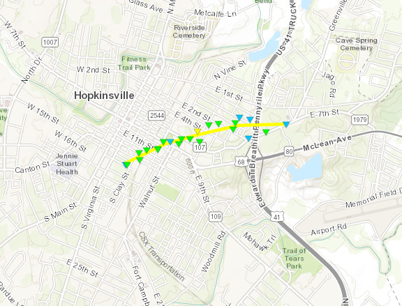 Image: Tornado track through Hopkinsville, KY Image: Tornado track through Hopkinsville, KY | 2. January 6 – Winter storm leaves behind a 3-6″ swath of snow across western Kentucky 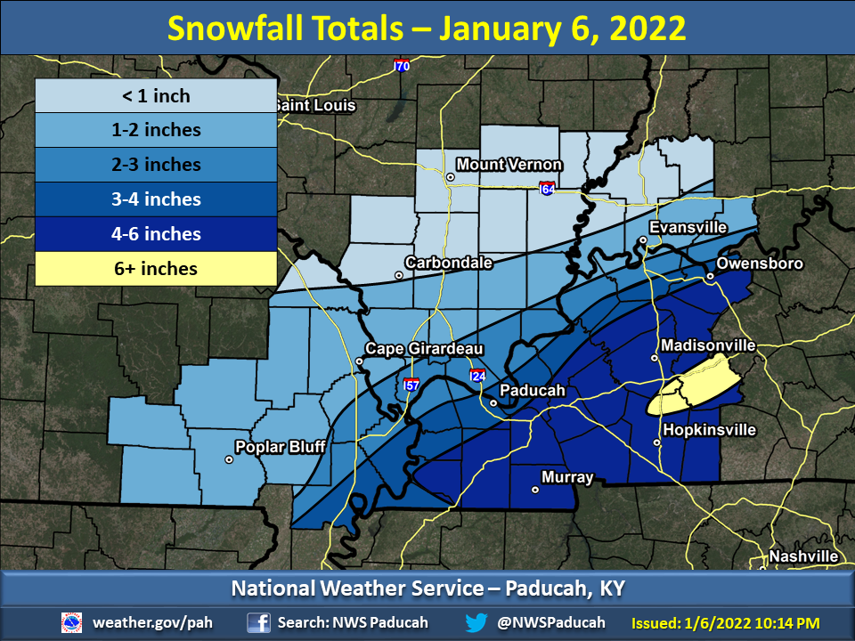 Image: Snowfall accumulations from this event Image: Snowfall accumulations from this event |
| 3. February 3-4 Ice storm across the western KY Pennyrile and moderate snow accumulations further west 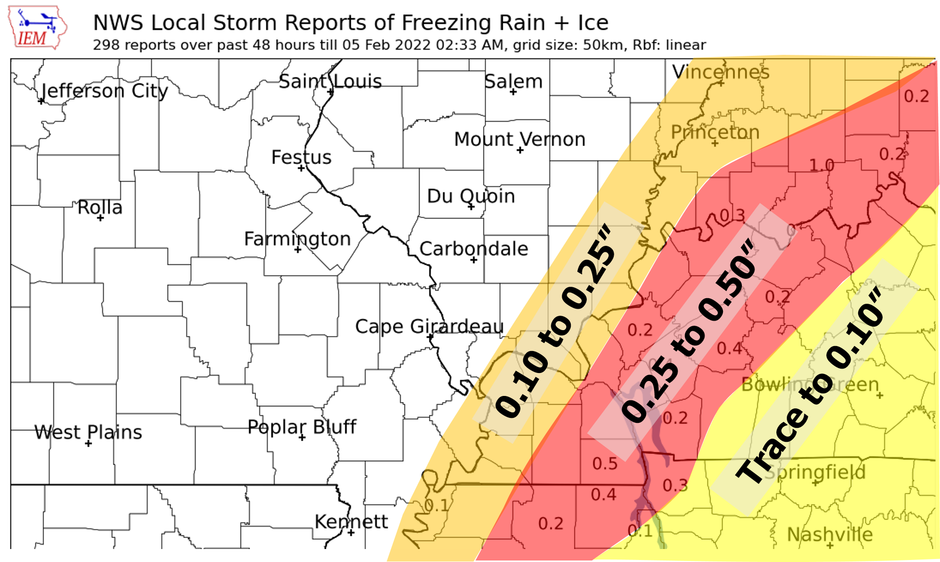 Image: Ice accumulations observed during this event Image: Ice accumulations observed during this event | 4. April 13 Severe weather produces 6 tornadoes across western KY 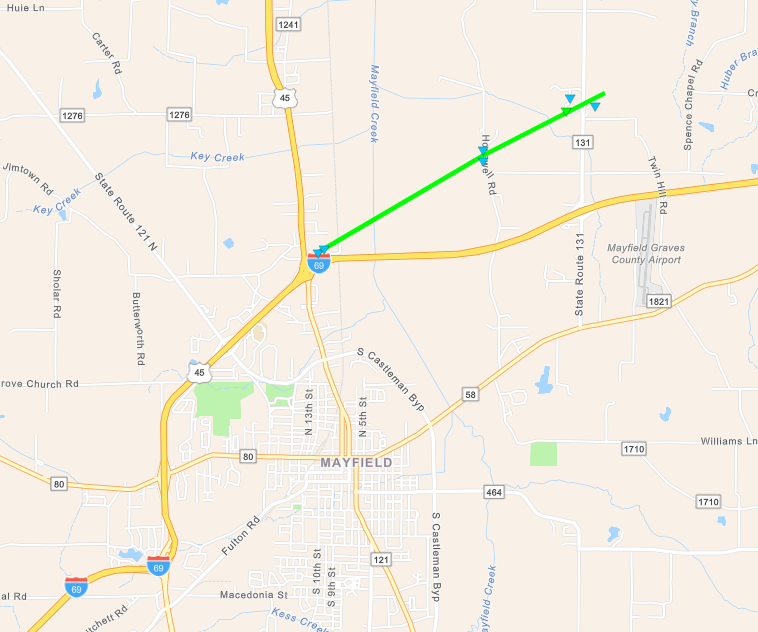 Image: EF-1 Tornado track map in the Mayfield, KY area Image: EF-1 Tornado track map in the Mayfield, KY area |
| 5. May 19 Severe weather along the I-64 corridor with an EF-2 tornado hitting Mt Carmel, IL 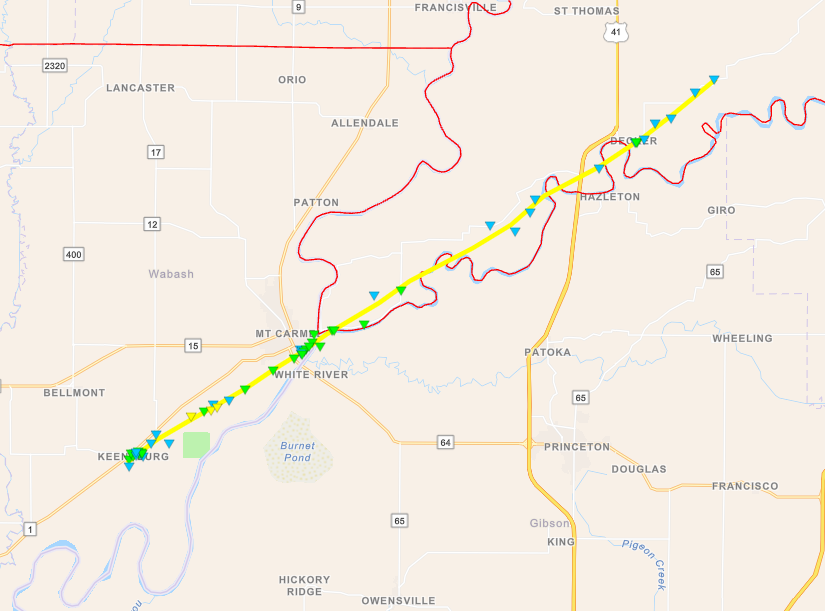 Image: EF-2 Tornado track that hit Mt Carmel, IL Image: EF-2 Tornado track that hit Mt Carmel, IL | 6. Summer Heat Waves: June 12-16, July 4-8, and July 20 All events produced heat index readings over 105 for an extended period with localized readings up to 120. 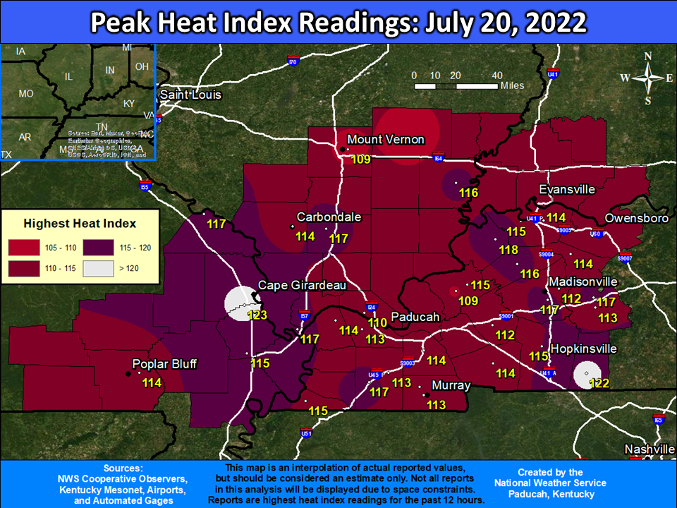 Image: Peak Heat Index observed on July 20, 2022 Image: Peak Heat Index observed on July 20, 2022 |
| 7. August 1 Severe weather produced significant wind damage across the Evansville, IN area 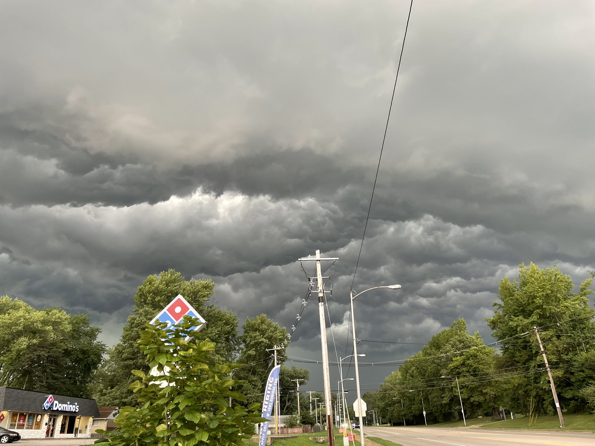 Image: Storm clouds in Evansville, IN courtesy of Kristin Valandra Image: Storm clouds in Evansville, IN courtesy of Kristin Valandra | 8. October 14 Rare wildfires in our area due to prolonged drought 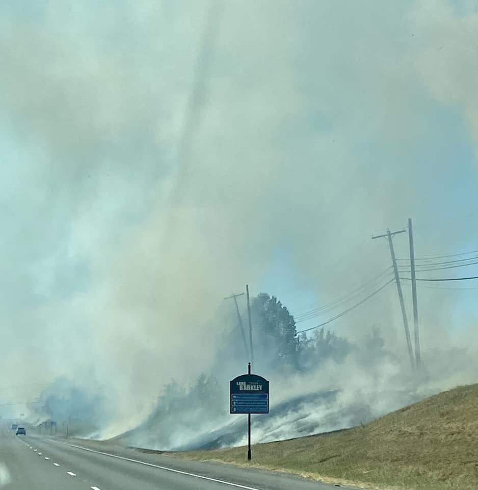 Image: Grass fire near Kuttawa, KY Image: Grass fire near Kuttawa, KYcourtesy of Mandy Neal and Beau Dodson |
9. Fall Drought & Record Low River Levels Many locations experienced one of their driest Falls on record. Most of the region was in Severe to Extreme drought by late November.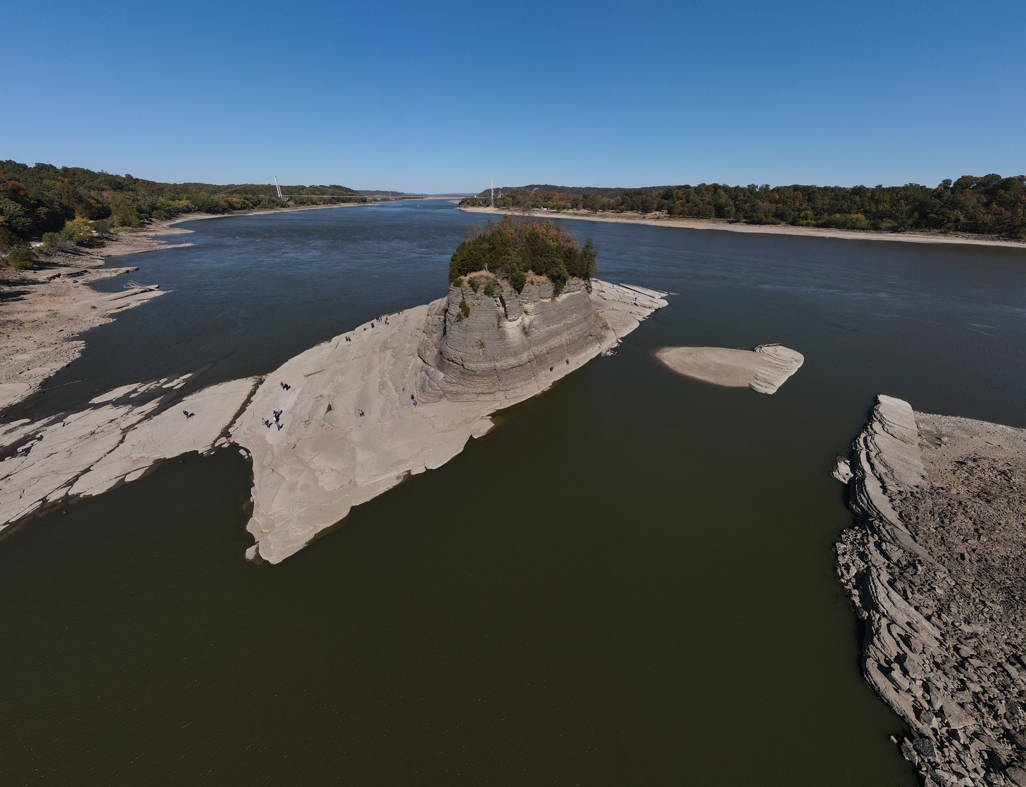 Image: Tower Rock along Mississippi River accessible by foot due to low river levels. Picture courtesy of Reece Streufer Image: Tower Rock along Mississippi River accessible by foot due to low river levels. Picture courtesy of Reece Streufer | 10. December 22-23 – Extreme Cold and Snow. Coldest wind chills in over 25 years with values of -20 to -30. 1 to 3 inches of snow on Dec 22 leads to first White Christmas since 2010. 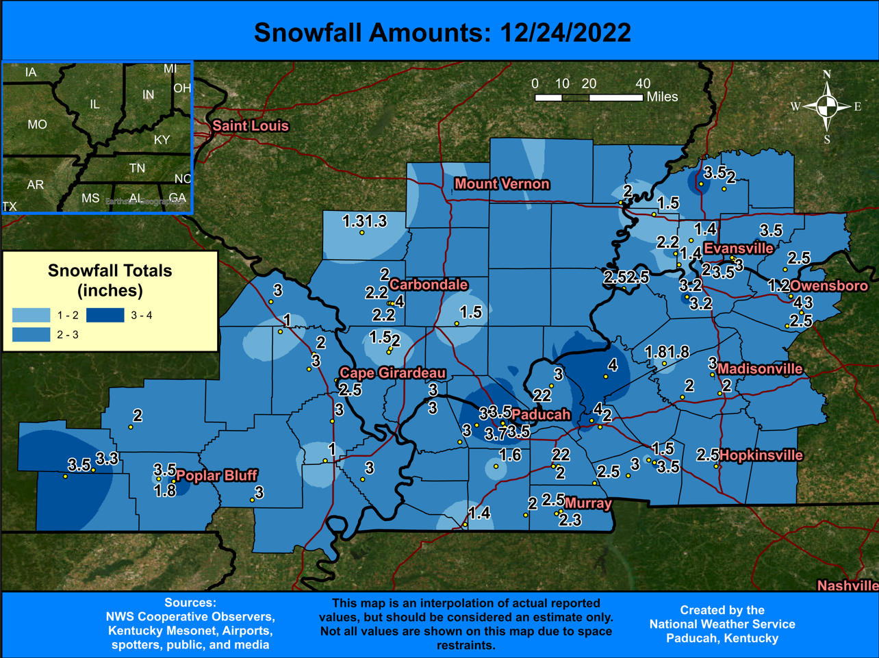 Image: Snowfall totals from December 22nd. |